This spoke trail is a close counterpart to Minuteman Bikeway in terms of easy public transportation proximity to great hike options.
It is a subtler thing, though. It's mainly a shanks mare adventure. Wellesley has an exceptional conservation land system.
The northern trail head is a 20 minute walk from the Riverside T Station along Grove St. in Newton Lower Falls, a sub-village of Newton. The entrance is a charming footbridge.
On the southerly bank lies Wellesley, a town invented by a banker during the gilded age at the end of the 19th century.
I followed it for a few miles and soon came to a single track segment through a floodplain forest along the Charles before it veers away from the river near Ouellet Playground.
From there, it is a fairly short street traverse before you reach the northern entrance to Wellesley Town Forest.
From the southern end at the Longfellow Pond parking lot, it is a fairly short walk to the Wellesley Hills commuter rail station.
The Charles River Link Trail is an outstanding community effort and runs all the way to Medfield.
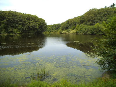
Longfellow Pond, Wellesley MA


.png)

I enjoyed the visit to the esker, especially the video. Very nice!From Doctor Jack of http://written-in-stone-seen-through-my-lens.blogspot.com.
ReplyDeleteI have been surprised by the number and variety of eskers I've found on various Bay Circuit Hikes.
ReplyDeleteI assumed many were just mined for gravel.
The Veterans Commemorative Forest in Pembroke abuts Silver Lake and that is only a few miles north of the outwash plain that begins in Kingston.
The Wellesley system is the tallest I've seen at around 160+ feet.
There must have been considerable melt water pressure to pile something up that high.
The Hog Back and Whale Back eskers along Route 9 and the Great Heath area of coastal Maine are also pretty impressive.