Showing posts with label Massachusetts Audubon Society. Show all posts

Saturday, November 3, 2012

Great Marsh Glimpses: Rough Meadows.

The Great Marsh by Martin Johnson Heade.

The Great Marsh extends from the New Hampshire border at the Merrimack mouth to a southern rampart made by Cape Ann. Its bulwarks against the open ocean consist of two chunky barrier strips, Plum Island and Cranes Beach.


The quieter space behind these barriers makes for an outstanding fish nursery, which, in it's turn attracts all manner of food chain participants. 

Another point of wonder is that much of it is fairly intact from encroachment by pollution and invasive species. It has its problems and is vulnerable to rising water that will likely accompany global warming. 

And then, there is the degree of excitement shared by the array of organizations that are converging attend to this bit of grandeur. I went up to that area in September to just cover the basic run of the Bay Circuit Trail from Joppa Flats to the Rowley commuter rail station

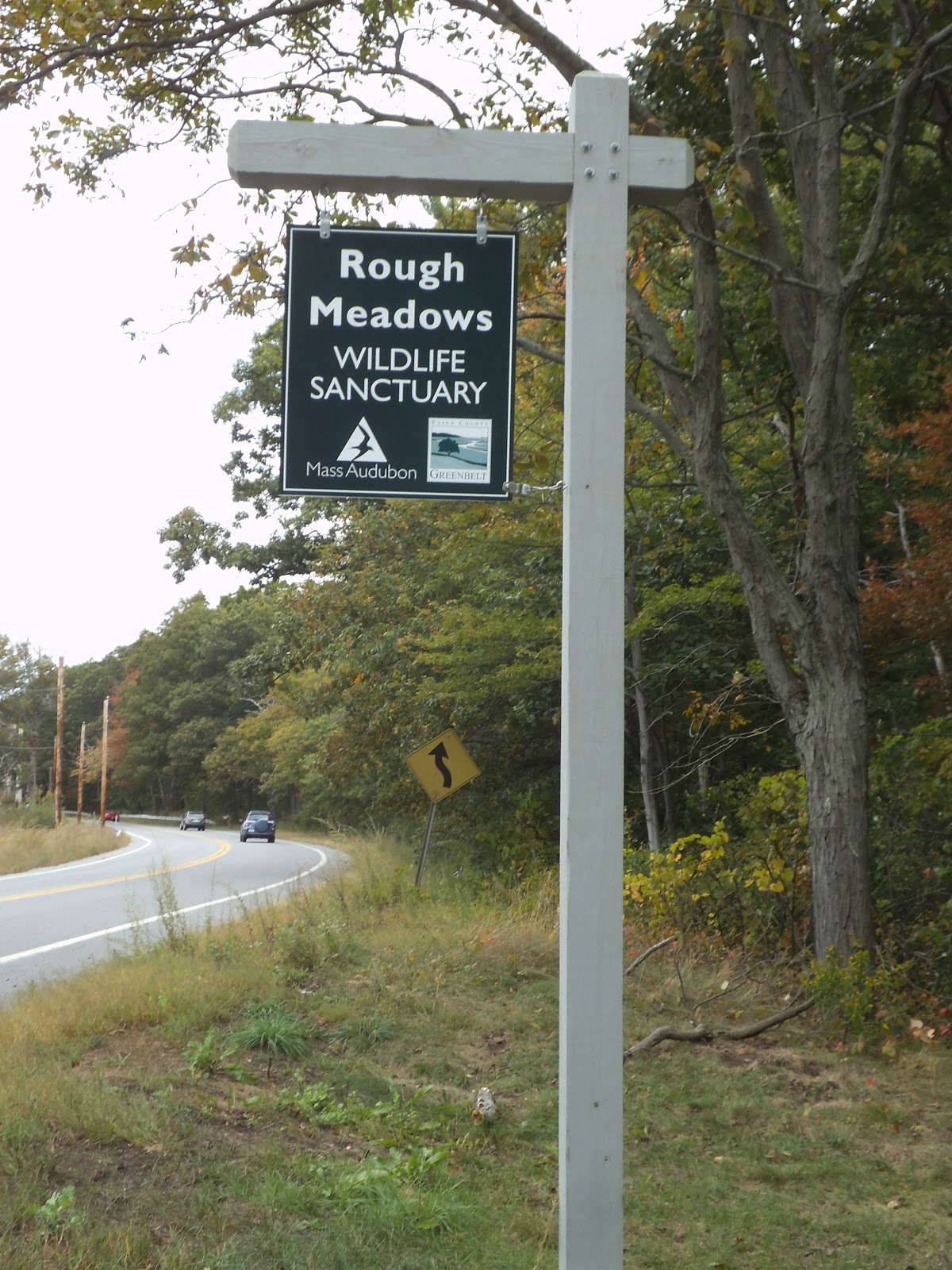
On a whim, I imposed myself on the volunteer staff at Joppa Flats and was taken by their excitement about the overall collaboration and the recent opening of the Rough Meadows Wildlife Sanctuary in the heart of it. I left with a Massachusetts Audubon membership renewal, (it's been years), a pile of printed material and an urge to follow up on the prompting of the gracious staff to explore the place.


I was back by the first of October, just at the cusp of the highest monthly tides. I was oblivious to tide timing and walked to the Sawyer Island parcel of the Essex County Greenbelt Association, all the way at the end of the road, first.


These properties belonged to Professor Alfred D Chandler Jr. and became his legacy contribution to this grand undertaking.

"Al loved to hunt, and he was a very good shot. During duck season, he could be found at daybreak in the marshes, then back in his study at midday, then back in the marshes."


The main access road into the Sanctuary passes along a stretch that can be immersed in high tide and so I found myself waiting for it to recede. 


It was an agreeable mission as it forced me to take long bemused looks around and discover things like Salicornia gravid from the brackish water. I also saw a fairly dense mass of infant fish feeding on algae. 

Once the tide let me pass I was free to follow Professor Chandler's Long Walk to its overlook spot to take in the demure vastness of it all.


On the way back I took in the Hickory Trail and Appy's Way. I'll return some day to explore the Sassafras Trail and The Kestral Trail. 

All in all it is an outstanding introduction to the quiet side of the Great Marsh.

Monday, August 20, 2012

Bay Circuit Trail: Walpole to Sharon Commuter Rail Loop.

Old Sawmill Pond, Walpole Town Forest

The Bay Circuit Trail and the Neponset River watershed intertwine gloriously here where commuter rail enables one of the more outstanding hikes in the system.


I've come to agree with Colonel Powell that the watershed may well be the primary unit of geographic organization and will increasingly orient content along that bearing.


I initially planned to enter the hike from Sharon and take it to Walpole but I ended up switching to follow the alignment of the trail description


This worked really well as you start from the river basin areas of Walpole and gradually rise to Moose Hill in Sharon.


Along the Bluffs Trail, Moose Hill Wildlife Sanctuary.

Another great facet of it is how the array of places along the route offer something for many diverse constituents. The extensive Town Forest tracts in Walpole work very well for trail running and biking while the more restricted portions in the Massachusetts Audubon Society lands are veritable area nature cathedrals.


The hike is generally relatively easy to follow and trail marking is particularly impeccable in Sharon, where the Warner Trail joins the Bay Circuit . I noticed that it shares a basic sandy soil matrix with Kingston on the coast suggesting the deposition patterns of relatively rapid glacial retreat that make an underpinning for the southern Bay Circuit's distinct array of ecotones.

The walk to the Sharon commuter rail station from Moose Hill is all down hill.


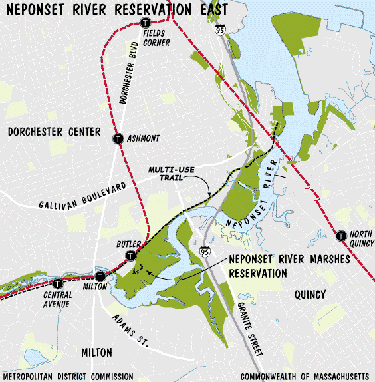
Courtesy Massachusetts Dept. of Conservation and Recreation.

The Neponset Estuary is also well lined with reservations and tracts and is an outstanding easy day visit by subway. It provides a great sense of basic riparian continuity dating back to the 1600s.


Neponset Estuary at Granite St Bridge.


There is a plan underway to join these elements until the Neponset Trail eventually meets the Warner Trail.The Walpole commuter rail run gives a sense of the route. 


Sunday, September 25, 2011

Bay Circuit Trail: Moose Hill Convergence.


Sharon, Massachusetts, along what I call the Southern Arc of the Bay Circuit Trail system is a counterpart activity hub to Andover. It has a number of protected lands including a cluster at Moose Hill consisting of the Massachusetts Audubon Society Sanctuary and Moose Hill Farm, owned by the Trustees of Reservations.


Moose Hill itself is also the height of land point for the southern arc and the swath of Southeastern Massachusetts rolling toward Providence.


Here is a handy summary.


"“A nice place to live because it’s naturally beautiful,” says a welcome sign in Post Office Square, and Sharon lives up to this motto.  “Lake Massapoag--the treasure of Sharon for its fun, beauty, and peacefulness,”  writes a student. “The Lake is about 400 acres of water. When the sun sets, beautiful, vibrant colors reflect off the Lake.”  Lake Massapoag is known for its concerts, fireworks, fishing, and good swimming on Memorial Beach.  From the 1800s until the 1940s, Sharon was a summer resort to which people would come to stay at inns and hotels to enjoy the clean air and the Lake. The Town proudly holds the 2,250-acre Massachusetts Audubon Moose Hill Wildlife Sanctuary, and has 60% of Borderland State Park comprising 1,260 acres within its borders, as well as the Warner, Massapoag Brook, and King Philip’s Rock nature trails.  In addition, the Town has been successful in preserving an additional 1,500 acres of its area of 24 square miles as public conservation land, totaling more than 5,000 acres of protected open space in Sharon."


Rick Ripley (above) has prepared a valuable series for his public access cable show.

It has it's own grassroots community organization, Sharon Friends of Conservation with an impressive content mix that includes a great overview.


The unifying element here is an array of trails. The Warner Trail leads of to the south all the way to Cumberland, Rhode Island. It parts company with the Bay Circuit Trail to the southwest near the borders of Foxborough and Walpole.


The eastward leg of the Bay Circuit Trail dips south along Lake Massapoag to meet Easton at Borderland State Park.
(Image Courtesy of Boston Public Library Photo Collection.)


This intrepid crew caught the annual rites of toad mating at Borderland.


Note For the Urban Carless. The wonders of Sharon are yours to discover through the capacities of commuter rail

Saturday, August 13, 2011

Ipswich River Wildlife Sanctuary,Topsfield MA.


The Ipswich River rises from diminished streams in the overbuilt and clobbered suburbs of Burlington and Wilmington with gathered tribute from Reading and Lynnfield as it passes along the southern edge of North Reading flowing east before a few step-wise meanders through Middleton to Topsfield where the Massachusetts Audubon Society maintains a crown jewel sanctuary known to me since I was a toddler.


From there it heads northeast to meet the sea at Ipswich


The Ipswich River Wildlife Sanctuary was acquired by Mass Audubon in 1951 from Thomas Procter. It was first converted to property in the 1640s on behalf of Simon Bradstreet after being a popular spot for eons with the Agawam people who left clam midden traces along the river and a path to the hilltop. 


This drumlin is the epicenter of the place where cars are parked, fees covered and the farmhouse and outbuildings rest.


The drumlin slopes are draped with Mr. Procter's work with a carriage trail as the first concentric ring. He was inspired by the English garden approach with adaptations shaped by Frederick Law Olmsted.

The Drumlin trail covers the introductions and experiments of the day. Osange Oranges are among the surprises in the arboretum. 

The Rockery is the most prominent feature and took more than five years to build. It overlooks a pond and the top is one of the best observation spots in the sanctuary.

The outer ring runs to increasingly lighter human touches until the wetland river edge are as they have been since before the heavy euro hand fell on it all. The North and South Esker trails overlook a substantial riparian panorama.  

Post Procter innovations owe more to Aldo Leopold and Art Flick. A substantial density of wood duck boxes dot the ponds. Astonishing skill and insight have been applied over the decades to maximize the potential habitat capacity and an intricate tapestry of ecotones bedeck the acreage. 

This effort makes it one of the best places ever to find nearly every bird likely to roost or pass through the region across the annual run of months. There is never a bad time to be there from the bare tree minimal mists of November to the neotropical mass convergence in May.
Hand feeding Chickadees is favorite past time in the wintry season. Stand near a spot where field meets thicket with reasonably serene stillness, a hand outstretched and a small pile of sunflower seeds, preferably hulled, and you'll soon have a regular Paridae chow line going on.


The mammal contingent includes fox and eastern coyote, beaver, fairly tame deer, otter, and all the others generally found in the area. 


Deer at Ipswich River Wildlife Sanctuary from Carl Thien on Vimeo.


And through it all, the river.


Monday, December 25, 2006

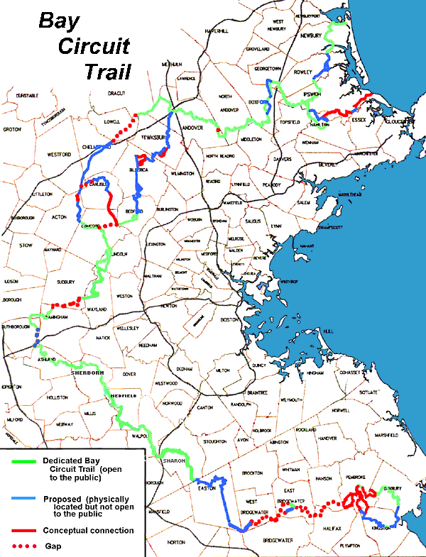
The Bay Circuit Trail.


The Commonwealth of Massachusetts embarked on a wonderful green space preservation experiment at the behest of "Charlie Eliot" .


Now, in the decades that have rolled by this trail system involving cooperation from 50 plus bickering cities and towns is more or less done. 


One of the marvels of it is simply the surprising diversity of landscape and habitat in the comparatively small land mass from the Merrimac River to the cedar swamp lands north of Cape Cod.


The Wisconsin Glacier sculpted what is now Massachusetts in a number of fascinating ways.


North of Boston its slower movement left a strew of large boulder erratics, some nearly the size of a house, long sinuous eskers that are actually raised stream beds, odd pound cake shaped hills called drumlins and beautiful kettle hole ponds, of which Walden is the most famous.


South of Boston the glacier moved faster and created sand barrens with larger particle size and faster drainage to make a plant community more suited to dryer conditions, such as scrub oaks and pitch pine. The region was also renewed by fire so many plant species selected for fire based seed release.


There are a number of vast Atlantic White Cedar Swamps such as the Hockomock, south of Stoughton, that have become de facto wilderness areas housing bobcat and deer.


There are subtle differences in coasts. The North arc that includes Newbury and Ipswich is a transition zone to rock coasts and cobble beaches of Maine. 


The South arc shares sandy similarities with the great beaches that follow the Atlantic Coast to the mangrove swamp regions along the Florida/Georgia boundary.


Neil Jorgenson's Sierra Club Guide to Southern New England is extremely useful for enhanced appreciation of this diversity in such a compact area as greater Boston and Al French has created a very useful website for anyone in the area seeking to explore this trail system.


There are significant web resources among the town jurisdictions, fed entities responsible for the National Wildlife Refuges and private non profits , most notably the Trustees of Reservations and the Massachusetts Audubon Society.