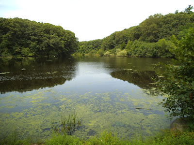
Old Sawmill Pond, Walpole Town Forest
The Bay Circuit Trail and the Neponset River watershed intertwine gloriously here where commuter rail enables one of the more outstanding hikes in the system.
Courtesy of Neponset River Watershed Association.
I initially planned to enter the hike from Sharon and take it to Walpole but I ended up switching to follow the alignment of the trail description.
This worked really well as you start from the river basin areas of Walpole and gradually rise to Moose Hill in Sharon.
Along the Bluffs Trail, Moose Hill Wildlife Sanctuary.
Another great facet of it is how the array of places along the route offer something for many diverse constituents. The extensive Town Forest tracts in Walpole work very well for trail running and biking while the more restricted portions in the Massachusetts Audubon Society lands are veritable area nature cathedrals.
The hike is generally relatively easy to follow and trail marking is particularly impeccable in Sharon, where the Warner Trail joins the Bay Circuit . I noticed that it shares a basic sandy soil matrix with Kingston on the coast suggesting the deposition patterns of relatively rapid glacial retreat that make an underpinning for the southern Bay Circuit's distinct array of ecotones.
The walk to the Sharon commuter rail station from Moose Hill is all down hill.
Courtesy Massachusetts Dept. of Conservation and Recreation.
The Neponset Estuary is also well lined with reservations and tracts and is an outstanding easy day visit by subway. It provides a great sense of basic riparian continuity dating back to the 1600s.
Neponset Estuary at Granite St Bridge.
There is a plan underway to join these elements until the Neponset Trail eventually meets the Warner Trail.The Walpole commuter rail run gives a sense of the route.


.png)
